


Hiking the Highland Backpacking Trail
- emoutdoors
- Aug 13, 2023
- 7 min read
Updated: Dec 31, 2023
Disclaimer: The information provided on Em Outdoors is for general informational purposes only. Your safety and well-being during outdoor exploration activities are your sole responsibility. It is important to understand and acknowledge our disclaimer.

Hello outdoor adventurers! I just got back from a backpacking trip in Algonquin Provincial Park in Ontario, Canada: The Highland Backpacking Trail and I want to share some insights from the trip. If you’re new to multi-day backpacking and are curious about doing a trip, I would highly recommend this trail. It’s well marked with maps posted at important intersections, has pretty minimal elevation gain, has cell phone service for most of the trail, and is close to Mew Lake Campground (i.e. help isn’t far if needed). I did this trail in high school and it was the first multi-day backpacking trip I ever did. This year, I did this trail with three other girlfriends, one of which was their first multi-day trip too.
P.S. if you need help figuring out how to pack for a backpacking trip, check out my other blog post which goes over everything you’ll need in detail: The ultimate backpacking packing list.
The Highland Backpacking Trail is a well-known trail in Algonquin Park and there are a lot of resources online to tell you about the loops, distances and best campsites. The trail is made up of two loops and looks like a figure 8 which gives you many options to choose your own adventure. You can find an outline of the trail here. However, the only reliable map we could find with campsites labelled was on the Ontario Parks website. To view it, we had to log in and proceed to make a reservation in order to see the map. For the trip, I ended up buying a map online through the official Algonquin Provincial Park website. **I thought this map was waterproof HOWEVER IT WAS NOT** Big mistake. The map did not last the trip. Luckily, we had someone with us who has done the trail many times so it wasn’t the end of the world.
WARNING: All the maps we found were different and there was no consistency with distances between campgrounds and lakes. Even the maps posted on the actual trail were inconsistent. This resulted in miscalculations in the length of our days. It wasn’t a huge deal, but when you’ve reached 12 kms hiking in a downpour, thinking you were only going to hike 9 kms that day…. ya.
We ended up doing the hike in 4 days, 3 nights. Our route was:
According to my GPS watch this was all about 37 kms total. See below where I’ll go into more detail about our route and the campsites we stayed at.

Day 1 - Saturday Aug 5: Highland Backpacking Trail trailhead to Provoking Lake
Distance: 5.8 km (originally calculated 5.4 km)
Campsite: Provoking-06
Total ascent: 170 m
Time (moving): ~2 hrs
Weather: Sunny and warm
Day one! Woohoo! We arrived at the Highland Backpacking Trail carpark which is just off Hwy 60 and labelled with a “32” marker on most maps (circled above). We got there around 12:30PM, waited for our other friends to come, and hit the trail around 1:15PM. The weather was perfect – sunny and not too hot. Bugs were manageable but noticeable. It was an easy day today as we only hiked two hours and the trail was not challenging.
The first campsite we stayed at was Provoking-06. Camps are labelled on the trail with bright orange signs and are easily recognizable (see picture below). We did get a bit lost because there was a discrepancy between how the campsites were numbered on the map versus on the trail. Our map showed Provoking-06 further down the trail from where the sign for the site was so we had to backtrack a bit. The park must have recently changed the numbering of sites around the lakes this year. For figuring out campsites, my advice would be to follow the signs in the park and not the maps as they can be outdated.
Provoking-06 is a beautiful site with a pretty open camping area, slightly shaded with a large rock face which juts out into the sun and slopes into the water. Great for swimming, reading in the sun and stargazing. See some pictures below of Provoking-06.


Day 2 - Sunday Aug 6: Provoking Lake to Harness Lake
Distance: 12.3 km (originally calculated 10.6 km)
Campsite: Harness-02
Total ascent: 378 m
Time (moving): 3.75 hrs
Weather: Sunny and warm
Another beautiful day. We woke up, ate our breakfast, took a dip, packed up and hit the trail at 11 AM. We hiked longer than I thought we were going to this day. It took us about 3.75 hrs to get to our next campsite on Harness Lake, Harness-02. That does not include our stop for lunch at Mosquito Creek (ironically the least buggy spot we could find to eat) which was about half an hour.
We rolled into our next campsite around 4 PM. I loved Harness-02 and it was probably my favorite site of the trip. It has an awesome spot for your tent which was grassy (so soft and luxurious!), perched on the side of the hill overlooking the water. Then, there’s a huge expanse of rock sloping down to the water with areas to sit and read in the sun, jump off the rocks or wade in and it also had some trees perfect for setting up a hammock. The fire pit is out on the rock as well. Since this site is so exposed it’s also essentially bug free.
We had lots of fun at this site. We shared the lake with some rowdy kids who were on was seemed to be a summer camp trip. I did not expect to be cat-called by a 12 year old in a canoe but yes, that did happen.


Day 3 - Monday Aug 7: Harness Lake to Faya Lake
Distance: 12.7 km (originally calculated 9.9 km)
Campsite: Faya-01
Total ascent: 369 m
Time (moving): 4.5 hrs
Weather: Torrential downpour from 10 AM to 4 PM, thunder, warm
Day 3: the day that broke us. We woke up, ate breakfast, went for a swim and packed up. Just as we finished breakfast, the rain started. This was not a light rain – it was a total downpour. We took the tent down in the rain which is my least favourite thing to do. We packed a lot of wet stuff into our bags, suited up with all our rain gear and set off on the already soggy on the trail.
The rain did not stop our entire hike that day. Eventually, everything was soaked. Even with our wrist Velcro sinched tight, water ran down our arms and into our jackets. Our pants and socks got soaked and it snuck into our boots and soaked them through. The water also somehow infiltrated all our dry sacks with our bedding and clothes. Nothing was safe. The mosquitos were somehow still out (?!) and were biting us on the only exposed area we had: our faces and hands. Rude. To top it off, the distance was almost 3 kms longer than expected and we got lost at one point and took a solid 20 minutes to figure out where we made a wrong turn.
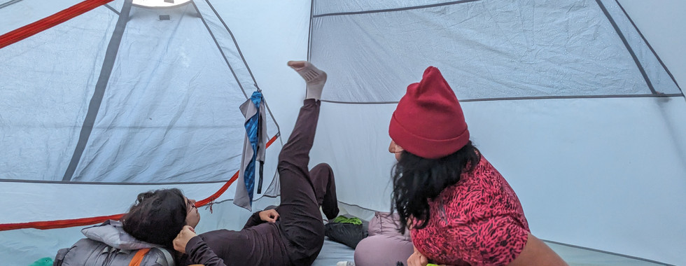
We got to our next site, Faya-01, around 3 PM and set up our tent in the rain. The rain finally subsided around 4 PM. We ate dinner shortly after at around 4:30 PM because we were so drained. We made a fire to try and warm up and it took a lot of effort to light it and keep it alive. After stoking it for about an hour and a half, we eventually gave up and hung out in our tent for the rest of the evening.
Faya-01 was a gorgeous site and is the only site on the trail where there is one campsite on the lake, so you get the whole thing to yourself! The campsite is on a little peninsula which extends into the lake and is fairly exposed. At the end of the point, there’s a little wooden bench to sit on and eat dinner and hang out. It’s unfortunately a bit weedy so not my favourite place for swimming. Needless to say a swim was not desired as I had basically already gone for one in the rain.
Don't forget to subscribe now to stay in the loop on all things outdoors and to get first access to new blog posts! See the form at the bottom of the page.


Day 4 - Tuesday Aug 8: Faya Lake to Highland Backpacking Trail trailhead
Distance: 6.7km (originally calculated 8.8 km)
Campsite: n/a
Total ascent: 163 m
Time (moving): 2 hrs
Weather: Drizzle, cloudy, warm
The last day! We woke up and were ready to be out. There was a bit of a drizzle in the morning when we got up. We ate breakfast, packed up everything, stuffed our wet tent in the bags, put on our wet boots (UGH) and took off at around 10 AM. The rain let up and drizzled on and off for the rest of the hike. Like Day 1, it was a pretty easy day and took us only 2 hours to get back to the carpark.
We were so glad that we had left a set of dry comfy clothes in the car.

All in all, the Highland Backpacking Trail is a great trail with beautiful campsites and I'd highly recommend it for those new to backpacking. If you have any questions or comments about this trip, or if you’ve done it before and have some tips of your own, feel free to comment below or shoot me an e-mail here.
Happy outdoorsing!